01935 429609
Somerset & Dorset
Family History Society
Family History Society
£2.40
Out of stock
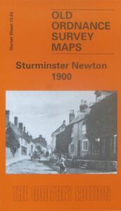
(Godfrey maps) A map of Sturminster Newton in 1900 at a scale of approximately 15 inches to the mile providing great detail, showing individual houses, railway tracks, factories and churches etc, and even minutiae such as pathways, signal posts, sheds, wells etc.
The rear of the map provides an introduction to the town, as well as a map of Bridge, a small community just to the south.